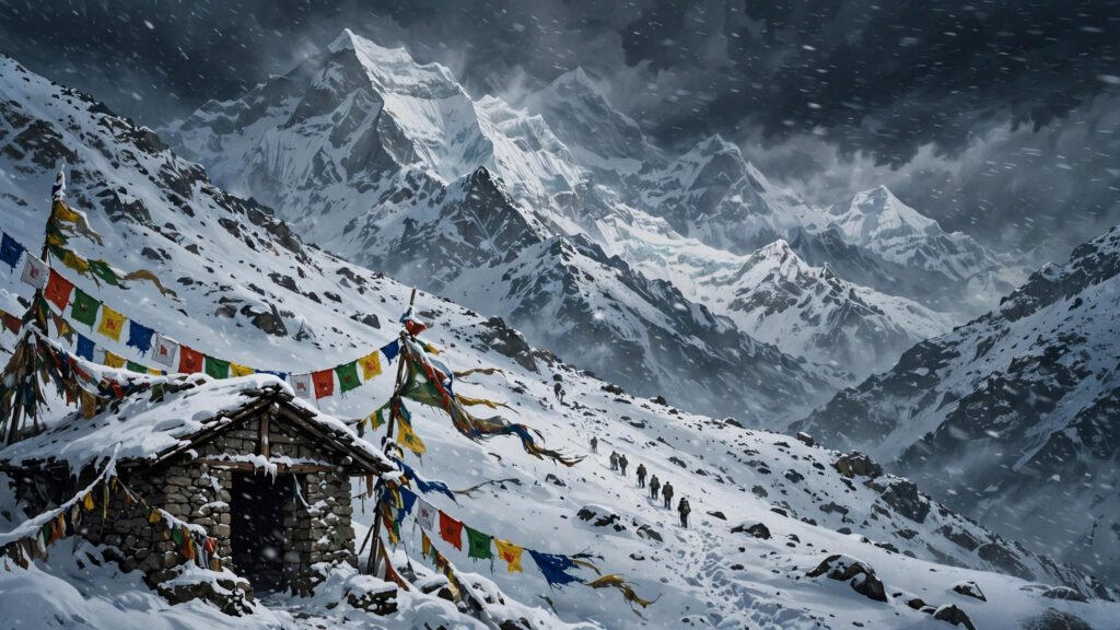
The remnants of Cyclone Arnab have brought heavy snowfall and rain across Nepal, stranding hundreds of domestic and foreign trekkers and shutting high-altitude trekking routes in the Himalayas. The system, which formed in the Bay of Bengal and struck India’s east coast on Wednesday, October 28, has weakened into a low-pressure area — but its moisture has kept Nepal wet since Thursday evening, with the heaviest conditions hitting the country’s eastern and central mountains.
Nepal’s Meteorological Forecasting Division reported on October 31 that most parts of the country were cloudy, with moderate rainfall in Koshi, Madhesh, Bagmati, Gandaki and Lumbini provinces and light rainfall in Karnali and Sudurpashchim. Heavy rain and snowfall were possible in one or two places in Koshi, Madhesh and Bagmati provinces, and the Division urged caution over heavy snowfall, snowstorms and landslides in the high hills and Himalayan regions.
Key Takeaways
- Cyclone Arnab’s remnants have brought heavy snowfall and rain across Nepal, stranding hundreds of trekkers on Himalayan routes.
- Nepal suspended high-altitude trekking permits from October 29 to 31, with Everest, Manaslu and Annapurna ranges most exposed.
- Weather officials say conditions should gradually improve from Saturday afternoon, with clear November weather expected from Monday, November 2.
Trekkers Stranded on Himalayan Trails
The extreme weather and freezing temperatures disrupted trekking along major routes, including the Kanchenjunga trail, trapping tourists travelling to and from base camps. Reports on October 31 said hundreds of trekkers were stranded as snow closed trails and mountain passes, turning what is normally the most reliable trekking season of the year into a hazardous week in the high mountains.
Authorities moved early to limit the risk. Nepal suspended trekking in its high-altitude Himalayan regions from October 29 to 31, and the Department of Immigration stopped issuing permits for restricted high-hill and Himalayan areas for those three days, asking trekkers and operators to stay away from mountain terrain. Sections of the Everest, Manaslu and Annapurna ranges were named as the most exposed, and mountain airstrips such as Lukla could close if conditions worsened.
The extreme weather and freezing temperatures disrupted trekking along major routes, including the Kanchenjunga trail, trapping tourists travelling to and from base camps.
Warnings Across Provinces
The Nepal Tourism Board urged domestic and foreign tourists to stay alert, avoid non-essential travel, and postpone treks and tours in high-hill and Himalayan areas until the weather improves. The National Disaster Risk Reduction and Management Authority said Koshi, Bagmati, Madhesh, Gandaki and Lumbini provinces could see moderate to heavy rainfall, with heavy snowfall, snowstorms and avalanches possible in the high hills and Himalayas.
Local administrations issued their own alerts. The District Administration Office of Kaski urged residents and visitors to remain highly alert, warning that heavy to extremely heavy rainfall accompanied by thunderstorms, lightning and strong winds could raise river levels, trigger flash floods and landslides, and cause road subsidence. Authorities in Lomanthang Rural Municipality in Mustang warned transport operators, drivers, traders and tourists against travelling toward the Korala border while conditions remained unfavourable.
- Hundreds of trekkers stranded as heavy snow hits Himalayan routes, including the Kanchenjunga trail
- High-altitude trekking permits suspended October 29 to 31
- Moderate rain in five provinces; heavy rain and snowfall possible in Koshi, Madhesh and Bagmati
- Kathmandu valley has seen continuous moderate rainfall for three days
- Weather expected to improve from Saturday afternoon, with clear skies from Monday, November 2
Three Days of Rain in Kathmandu Valley
The disruption has not been limited to the mountains. The Kathmandu valley and various parts of the country have experienced continuous moderate rainfall for the past three days, according to the Weather Forecasting Division. The low-pressure area sat near western Nepal on October 31, bringing moderate rain and snowfall to Bagmati, Gandaki, Lumbini and Karnali provinces and parts of Koshi and Sudurpashchim.
The Division also asked the public not to carry out agricultural activities, including rice harvesting, on October 31 and November 1, as rain and snow continued to affect farming areas. In the Terai lowlands, light rainfall was reported in parts of Lumbini and Sudurpashchim provinces, while the heaviest bursts in the east and centre were expected to last no more than one or two hours at a time.
Forecasters stressed that this is now a weak system bringing long, mostly light rain rather than a storm striking Nepal directly. Arnab made landfall on India’s east coast on October 28, and Nepal’s disaster authority had warned that its moisture would reach the mountains from the night of October 29. The system weakened into a low-pressure area, but the rain it carried has lingered longer than a direct hit would have.
What to Watch Next
What to watch next is what the forecasts already point to: rainfall and snowfall diminishing progressively after noon on Saturday, with conditions gradually improving from Saturday afternoon and clear November weather expected from Monday, November 2. Trekkers and operators will be watching for local confirmation that trails have reopened and fresh snow has settled, since deep new snow brings avalanche and route-finding risks for several days after a storm. Lower-altitude cultural tours and city travel have not been suspended, and Kathmandu and Pokhara remain open — but high trails should stay off limits until the all-clear is confirmed locally.
Related coverage on NightLust News: how Nepalese run daily life across the mountains on their phones, and the Mayon volcano eruption that evacuated 2,000 people in Albay this week.