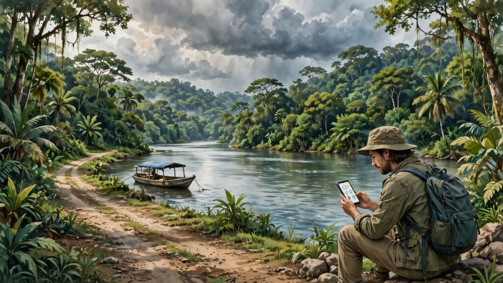
In Guyana, a journey is rarely just a drive from one point to another. The country stretches from the Atlantic coast to rainforest and savannah, and the route between two towns can involve a road, a river crossing, and a stretch of track that changes with the rain. That is why so many Guyanese reach for their phones before they leave home: a quick check of travel and weather updates can decide whether a trip goes ahead, waits a few hours, or takes a different route.
This habit is not about checking a screen for its own sake. It is about planning around conditions that can change fast, especially outside the main coastal corridor.
Key Takeaways
- Guyana’s journeys often combine roads, rivers and ferries, so conditions on one part of the route can affect the whole trip.
- Rain can change road and river conditions quickly, which is why checking updates before leaving matters.
- A phone check works best alongside local advice, flexible timing and a backup plan.
Why One Route Can Mean Several Kinds of Travel
Much of Guyana’s population lives along the coast, where the main roads link the capital, Georgetown, with towns to the east and west. Travel within this corridor is usually straightforward. But journeys into the interior often work differently. A traveller may drive part of the way, wait for a ferry or a river crossing, and then continue on a road that is unpaved or remote.
Each stage has its own timing. Ferries and boats run to schedules that can shift with water levels and weather. A road that was passable in the morning may become difficult after heavy rain. Checking updates in advance helps travellers connect these stages instead of arriving at a crossing only to find a long wait.
For people visiting family, going to work, or moving goods, that information saves more than time. It helps them avoid setting out on a journey that cannot be finished the same day.
How Rain Changes the Picture
Rainfall is the single biggest reason a Guyanese travel plan changes. Heavy rain can flood low-lying roads, make unpaved surfaces slippery, and raise river levels. On the coast, drainage and tides also play a part, and a route that looks fine on a map may still be affected by standing water after a downpour.
A quick check of travel and weather updates can decide whether a trip goes ahead, waits a few hours, or takes a different route.
In the interior, rain affects rivers in a different way. Higher water can make some crossings faster, while low water in a dry spell can slow boats or limit where they can go. Travellers who follow river and weather updates get a clearer sense of which option is realistic on a given day.
This is why the phone check is often repeated, not done once. A forecast in the morning may look different by midday, and a traveller who checks again before the return journey is less likely to be caught out.
- Check the forecast and any travel notices before leaving, not after setting out.
- Allow extra time for ferries, river crossings and unpaved stretches.
- Keep a backup plan for delays, including where to wait safely.
- Ask locally as well as online, since conditions on a small road can change faster than an app updates.
What Travellers Usually Check
A useful phone check covers a few simple questions. What is the weather along the whole route, not just at the starting point? Is there any notice about a ferry, bridge or road closure? How long is the journey likely to take in current conditions, rather than in ideal ones?
Many travellers also check messages from family and friends along the route. Someone who travelled the same road earlier in the day often has the most current picture, and a short message can confirm what an app only suggests. This mix of official notices, forecasts and word of mouth is a practical part of travel in Guyana.
Similar habits appear in other countries where weather shapes daily movement. In the Philippines, for example, people check typhoon alerts on their phones before storms arrive, while in Uruguay farmers check rain forecasts before farm work. In Bonaire, travellers and water-sports enthusiasts check wind and sea conditions before heading out. The details differ, but the logic is the same: check first, travel smarter.
Staying Connected on the Move
Staying connected is not always simple on a long Guyanese journey. Mobile coverage is strongest in coastal towns and cities and can be patchy in remote areas. That is another reason the check happens before departure: travellers download what they need, save key numbers, and tell someone their plan while they still have a strong signal.
Charging matters too. A phone used for maps, messages and updates can run low on a long trip, so many travellers carry a charger or a power bank. It is a small habit, but it keeps the travel information available for the return leg as well as the outward journey.
None of this replaces local knowledge. Boat operators, drivers and people living along a route often know the day’s conditions better than any single source. The phone brings the forecast and the notices together; local advice fills in the gaps.
What to Watch Next
For Guyanese travellers, the habit of checking travel and weather updates before leaving is likely to stay central to how journeys are planned. As mobile coverage and travel information improve, the checks may become faster and more detailed, covering more routes and more river crossings. What will not change is the reason behind the habit: in a country where roads, rivers and weather shape every journey, knowing conditions before departure remains the simplest way to travel safely and with fewer surprises.